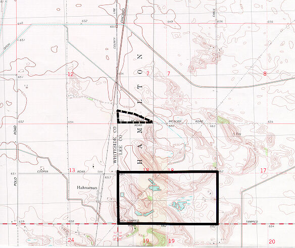
Nature Preserve Area
10
County
Lee
Location And Access
From Rock Falls toll Highway 88 south 9 miles to a county road (Tampico Road) turn east on the county road and go 3 miles to a county road (County Line Road). Turn north on this road and go 1 mile. The preserve is at the intersection of County line Road and Foley Road, east of County Line and north of Foley
Description
This site, formerly called County Line Prairie, contains dry mesic and dry sand prairie representative of the Green River Lowland Section of the Grand Prairie Division. Although it has been grazed in the past, it is recovering from this disturbance. June grass and little bluestem are the most common plants of the dry sand prairie while big bluestem and switch grass are common in the dry mesic prairie. A large number of wildflower species, including pale purple coneflower, purple prairie clover, Culver's root, rough blazing star and rosin weed are present in this prairie.
Ownership
Illinois Department of Natural Resources
Dedicated
May 1988
Size
15.2 acres
Topographic Quad
Hahnaman
For Further Information
Illinois Nature Preserves Commission
One Natural Resources Way
Springfield, IL 62702
217-785-8686
or Site Superintendent, Green River Conservation Area, 375 Game Road, Harmon, IL 61042 (815/379-2324)


