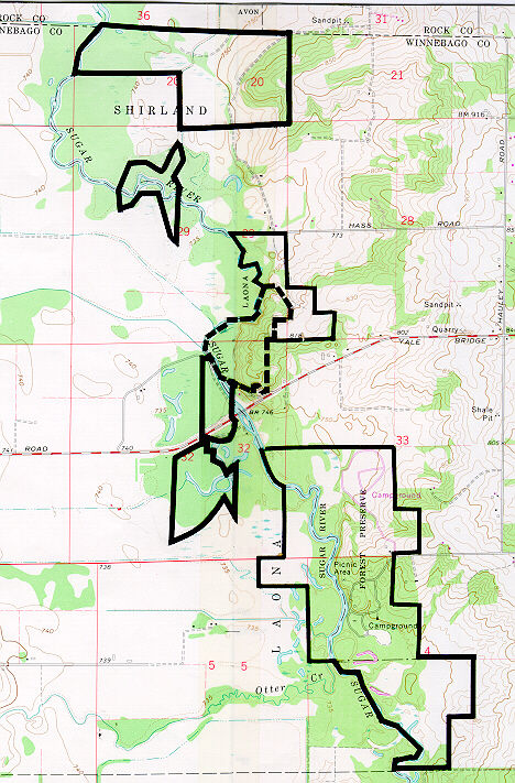
Nature Preserve Area
1
County
Winnebago
Location And Access
From Shirland, take Boswell Road north 2.5 mi. to Yale Bridge Road, then turn and go west 1.5 mi. to Hauley Road, then turn and go north 0.5 mi. to Haas Road, then turn and go west 1 mi. to Colored Sands Forest Preserve. The nature preserve is in the forest preserve and is to the south of Haas Road.
Description
Colored Sands Bluff is located along the Sugar River. The natural features include eroding bluffs, dry sand savanna, dry dolomite prairie, dry and dry-mesic sand prairie of the Freeport Section of the Rock River Hill Country Natural Division. The preserve also contains bottomland forest and perennial stream of the Winnebago Section of the Northeastern Morainal Natural Division. The topography of the area was formed by wind-deposited sand after the last glaciation. The sand deposited on dunes and ridges that were eventually stabilized by forest and prairie vegetation. One of the larger dunes has been dissected by the river, forming a 40 foot sand bluff. Small outcrops of St. Peters Sandstone, known locally as Colored Sands, is found on the southern end of the preserve. A birdbanding station on the preserve, established by former owner Lee Johnson, has shown the importance of Sugar River as a migration route. Over 85,000 birds have been banded representing over 150 species. The area also provides unique habitat for several unusual reptiles and amphibians, including fox snake, milk snake, western hognose snake, Blanding's turtle, and the uncommon blue-spotted salamander. This preserve is on two topo maps; Shirland and Durand 7.5.
Ownership
Winnebago County Forest Preserve District
Dedicated
August 1976
Size
241 acres with buffer
Topographic Quad
Shirland
For Further Information
Winnebago County Forest Preserve District, 5500 Northrock Dr., Rockford, IL 61103 (815/877-6100)
1/2009 - R. Heidorn


