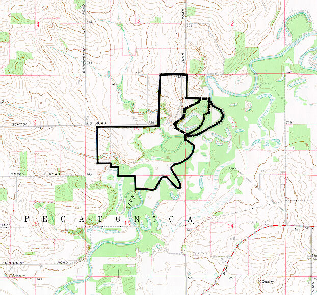
Nature Preserve Area
1
County
Winnebago
Location And Access
From US Rt 20 approximately 13 miles west of downtown Rockford, travel north on Pecatonica Rd. (County 18) through Pecatonica, a total of 4.5 miles to Brick School Road (County 83); then east 2 miles and around the curve to the north to the main entrance to Pecatonica River Forest Preserve. Walking trail to the Nature Preserve begins at the picnic shelter.
Description
Situated on the floodplain of the Pecatonica River, in the Freeport Section of the Rock River Hill Country Natural Division, Pecatonica Bottoms includes wet and mesic floodplain forest, dominated by black maple, basswood and black walnut. Pileated woodpeckers and bald eagles have been sited along the river in or near the floodplain woods. The preserve also protects an oxbow lake and shrub swamp, and habitat for the blue-spotted salamander. The preserve is part of a larger forest preserve area that is used primarily as an environmental education resource. An observation deck along the marked trail provides a beautiful overview of the oxbow. In late winter/early spring, the maple trees are tapped for limited production of maple syrup
Ownership
Winnebago County Forest Preserve District
Dedicated
September 1982
Size
36.4 acres nature preserve, 22.4 acres buffer
Topographic Quad
Pecatonica
For Further Information
Winnebago County Forest Preserve District, 5500 Northrock Dr., Rockford, IL 61103 (815/877-6100)
1/2009 - R. Heidorn


