Nature Preserve Area
10
County
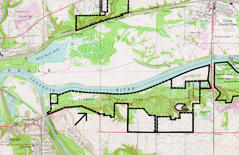
La Salle
Location And Access
From Oglesby, take Highway 71 east and cross the Vermilion River. The preserve is on the north side of the road after crossing the river.
Description
This site, with its deep canyons and sandstone cliffs, has a rich cultural and biological history. Native Americans used the site, and a fort was built here by the French in the 1700's. White pine, Canada yew, and northern white cedar, plants that are more common farther north, occur on the sandstone cliffs. The least disturbed plant communities are dry-mesic upland forest, mesic upland forest and dry upland forest. White oak, red oak and black oak are common in all three plant communities. Many very old trees are present in the canyons throughout the park.
Ownership
Illinois Department of Natural Resources
Dedicated
May 1967
Size
699.85 acres with buffer
Topographic Quad
La Salle
Topo Map
For Further Information
Illinois Nature Preserves Commission, One Natural Resources Way, Springfield, IL 62702, (217-785-8686), DNR.INPC@illinois.gov
or Site Superintendent, Starved Rock State Park, Utica, IL 61373, (815-667-4726)