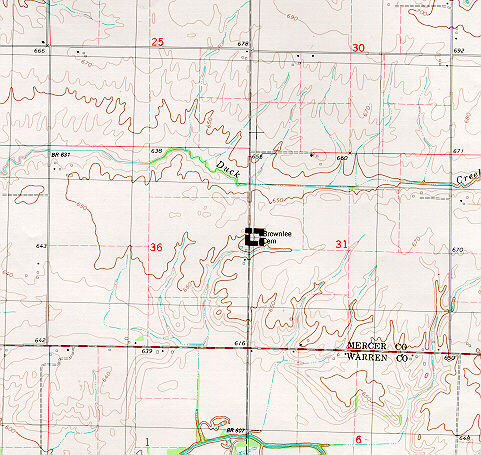
Nature Preserve Area
10
County
Mercer
Location And Access
From Alexis, take Hwy. 135 west 4 miles to blacktop road, then turn and go north 0.6 mile. The nature preserve is east of the road.
Description
Brownlee Cemetery Prairie is a remnant of mesic prairie in the Galesburg Section of the Western Forest-Prairie Natural Division. Brownlee cemetery dates back to 1842 when Thomas and Anne Brownlee deeded 3 acres of land to the Associate Church of North Henderson for a church and burial ground. The last burial took place in 1942 and since then the cemetery prairie has maintained much of its original character. Today this mesic black soil prairie consists of Indian grass, big bluestem, little bluestem, leadplant, wild bergamot, yellow coneflower, and rattlesnake master.
Ownership
Mercer County Soil and Water Conservation District
Dedicated
September 1982
Size
2.8 acres with buffer
Topographic Quad
Little York
For Further Information
Mercer County Soil and Water Conservation District, 308 Southeast Eighth Avenue, Aledo, IL 61231 (309/582-5154)


