Nature Preserve Area
6
County
Vermilion
Location And Access
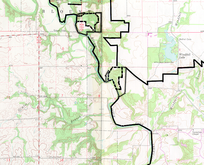
This is an isolated preserve that is difficult to reach. The best access is by wading the Middle Fork River or by canoe. To reach the preserve by wading the river start from the town of Collison. Take the county road east out of Collison for 1.75 miles. Park where the road turns south. This is the boundary of the Middle Fork State Fish and Wildlife area. Walk 0.75 mile to the river. The preserve is directly across the river, which can be waded during periods of low water. To reach the preserve by canoe start from Collison. Take the county road north out of Collison one mile to another county road. Turn east on this road and go 1.5 miles. Just before the river is the Kinney's Ford Day Use Area. Park here and launch the canoe in the Middle Fork. The preserve is about 2.25 miles downstream on the east side of the river.
Description
This preserve is located adjacent to the Middle Fork of the Vermilion River. This region of Illinois is characterized by a rugged topography and beech-maple forests which are present in the ravines along the Middle Fork. Calcareous seeps containing unusual plants for this part of Illinois are also typical. The seep is the least disturbed community in the preserve. The predominant plants are black ash, buttonbush and water parsnip. This site is one of the few known stations for black ash on the Middle Fork. Current management programs include restoration of an old agricultural field and protection of the site. A rerouted horse trail located on the south boundary is proving to be beneficial in protecting the integrity of this preserve and Windfall Prairie.
Ownership
Vermilion County Conservation District
Dedicated
May 1979
Size
51.8 acres nature preserve, 39.2 acres buffer
Topographic Quad
Danville Northwest
Topo Map
For Further Information
Vermilion County Conservation District, RR #1, Box 215, Danville, IL 61832 (217/662-2142)