- At least one responsible adult must accompany each group of 15 minors.
- Pets must be kept on leashes at all times.
- Actions by nature can result in closed roads and other facilities. Please call ahead to the park office before you make your trip.
History
Salt is the theme of the early history in the area around Equality in Gallatin County. One of several counties originally part of Gallatin, Saline County takes its name from the salt works. American Indians made salt here long before the first settlers appeared. In 1803 the Indians ceded their "Great Salt Springs" to the United States by treaty. Congress refused to sell the salt lands in the public domain but did authorize the Secretary of the Treasury to lease them to individuals for a royalty. The leases required the holder to produce a certain quantity of salt each year, or pay a penalty.
Although the northwest ordinance prohibited slavery in this area, special territorial laws and a constitutional provision permitted exceptions at these salines. The leasees brought in slaves or indentured servants and used them extensively in manufacturing salt. The census of 1820 for Gallatin County listed 239 slaves or servants.
In 1818, as part of the process of making a new state, Congress gave the salines to Illinois but forbade the sale of the land. The state continued to lease the springs and used the revenue to finance part of its operating expenses. Eventually Congress allowed the outright sale of the land. The commercial production of salt made the expense of extracting it from the brine prohibitive.
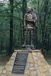
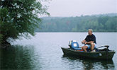
Glen O. Jones Lake, with a maximum depth of 35 feet and a 2.7 mile shoreline, is the focal point of the area. The lake was named for a prominent Saline County citizen who served in the Illinois General Assembly. Senator Jones also was twice elected state's attorney of Saline County and was a member of various social and fraternal organizations.
Directions
To reach Saline County State Fish & Wildlife Area, take Rt. 13 East from Harrisburg, turn right onto Rt 142, travel 1 mile, turn right, drive 5 miles to the Park entrance. From Eldorado, go south on Rt. 142 approximately 7 miles, turn right just past the Saline County State Fish & Wildlife sign and travel 5 miles to the park. From the Ohio River bridge at Shawneetown, travel west on Rt. 13 to Rt. 142, turn left, drive 1 mile and turn right again just past the park sign and drive 5 miles on the blacktop to the park.
While groups of 25 or more are welcome and encouraged to use the park's facilities, they are required to register in advance with the site office to avoid crowding or scheduling conflicts.
We hope you enjoy your stay. Remember, take only memories, leave only footprints.