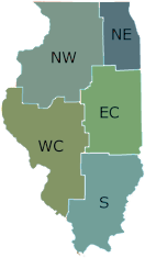
Spring Lake Fish and Wildlife Area is located in Tazewell County, 25 miles southwest of Peoria, on the east side of the Illinois River.
In 1950 the state made the initial land acquisition of the 632 acres. The total acreage is now 2,032.
The lake lies almost parallel to the Illinois river for 8.5 miles up the river bottoms, along the base of the river's east bluff. Spring Lake was described as a meander by an 1840 survey, and title was given to the State of Illinois. Overlooked by a large sandstone bluff, Spring Lake is a long, narrow lake created by a meander of the Illinois River. The lake covers an area of 1,285 acres, has a maximum depth of 10 feet and has 18 miles of shoreline.
The lake water level was raised by the construction of a higher dike in the late 1950s. The expanded lake was completely filled by 1960. The new lake was completely filled by 1960. The new lake is nearly twice the size of the old Spring Lake and has also inundated another lake known as Saiwell Lake.
Directions
From the city of Pekin, take Illinois Route 29 south approximately 1 mile to Manito Road, turn right (west) and go 10 miles to Spring Lake Road (1000 North), Turn Right (west) and go 3 miles to North Park Entrance. You will then be able to follow signs to the South Park.
If traveling north on Illinois Route 29, at the town of Green Valley, turn left (west) on Toboggan Avenue (6000 North) and go 7.5 miles to Manito Road (2960 East), turn right (north) and go 4 miles (through the town of Manito) to Spring Lake Road (1000 North), turn left (west) and go 3 miles to the North Park Entrance. You will then be able to follow signs to the South Park.
Northwestern Illinois
7982 South Park Rd.
Manito
61546
40.473
-89.868


