GIS Maps
The following maps are produced using Geographic Information System Technology. For Interactive Maps, see the OWR Publications Page.
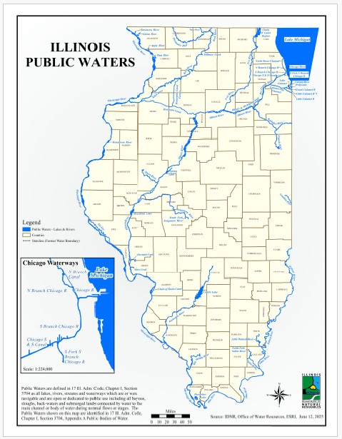
Illinois Public Waters
Public Waters are defined as all lakes, rivers, streams and waterways which are or were navigable and are open or dedicated to public use including bayous, sloughs, backwaters and submerged lands connected by water to the main channel or body of water during normal flows or stages. The Public Waters shown on this map are identified in 17 Ill. Adm. Code, Chapter I, Section 3704, Appendix A Public Bodies of Water.
Click on the map for a full and printable view. An interactive web map is also available.
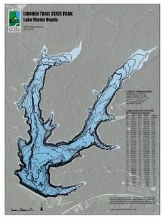
Lake Depth and Capacity
Depth contours and lake volume developed from IDNR Office of Water Resources bathymetry surveys are shown in this Lake Depth and Capacity web application. Maps and capacity graphs can be downloaded from the Lake Depth and Capacity interactive map by selecting a lake boundary and saving the pdf attachments.
Click on the map to start the web map.
100-Year Floodplain in Illinois
The 100-year floodplain represents that portion of the topography that would be inundated during a flood event which has a 1% chance of occurrence in any given year. The mapped 100-year floodplain area represents the best available data as of September 2024.
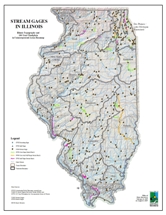
Stream Gages in Illinois
Stream gages monitor streams and collect information such as water height and discharge. This information is useful for flood prediction, water management, recreation and navigation purposes. The location of stream gages maintained by the USGS and IDNR Office of Water Resources are shown on this map. The map also shows the stream gages in relation to the underlying topography, major watershed boundaries and streams.
Click on the map for a full and printable view.
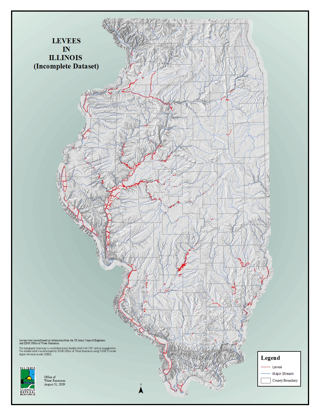
Levees in Illinois
Levees are usually earthen embankments that contain, control, or divert the flow of water to provide some level of protection from flooding. Levees in this map were located based on information from the US Army Corps of Engineers and IDNR Office of Water Resources.
Click on the map for a full and printable view.
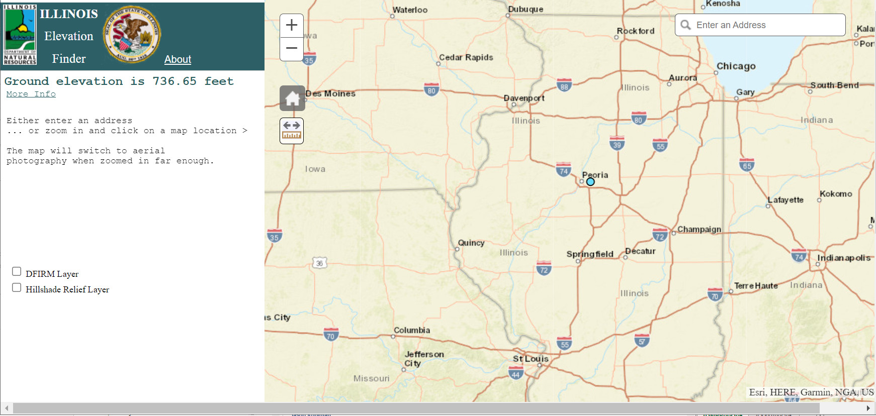
http://maps.dnr.illinois.gov/elev/
The Elevation Finder Application, developed by IDNR Office of Water Resources, allows users to determine the ground elevation in NGVD 88, anywhere in Illinois, from statewide LiDAR. The application also provides a floodplain mapping layer when available (DFIRM Layer) from the National Flood Hazard Layer Viewer and a Hillshade Relief Layer from the Illinois State Geological Survey. Both of these layers, as well as an aerial image, draw when a user is zoomed into an area of interest and the layer is selected. The About link in the application provides detailed source information associated with the layers shown in the application. The More info link in the application provides the user with Lidar metadata related to the county, projection, and year of data collection. CHROME IS THE RECOMMENDED BROWSER FOR THIS MAP. http://maps.dnr.illinois.gov/elev/