Office of Water Resources Programs
The Division of Water Resource Management, Regulatory Programs
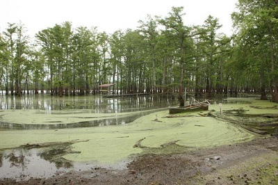
The Division of Water Resource Management is responsible for regulating activities within or adjacent to Illinois rivers, lakes and streams; administering the state floodplain/floodway mapping ; allocating and monitoring water use from Lake Michigan; coordinating the National Flood Insurance Program; and administering the nonstructural flood mitigation program.
These responsibilities are carried out through four program sections:
- 1. Northeastern Illinois Regulatory Programs
- 2. Downstate Regulatory Programs
- 3. Statewide Programs
- 4. Lake Michigan Programs
- 5. Dam Safety Program
- 6. Levee Safety Program
- 7. Technical Advice and Referral
- 8. Flood Mitigation Planning / Design / Construction
- 9. Criteria For State Participation In Flood Control Projects
- 10. Operation of McHenry, Algonquin and Sinnissippi Dam
- 11. Water Supply Planning
- 12. Intrastate Cooperation
- 13. Interstate Planning
The Northeastern Illinois Regulatory Programs Section is responsible for floodplain management activities in the metropolitan Chicago counties of Cook, DuPage, Kane, Lake, McHenry and Will. Permits are issued for construction of dams, construction in the floodway of streams and activities in and along public bodies of water. The section administers a program through which local governments are delegated authority to approve construction projects under the state's floodway construction rules. The section assists the Statewide Programs Section in the coordination of the National Flood Insurance Program.
The Downstate Regulatory Programs Section is responsible for floodplain management activities in the remaining counties. Permits (see Permit Programs) are issued for construction of dams, construction in the floodway of streams and activities in and along public bodies of water. The section assists the Statewide Programs Section in the coordination of the National Flood Insurance Program.
The Statewide Programs Section is responsible for non-permit programs that are applicable in all areas of the state including floodplain management training workshops statewide, community assessment visits, ordinance reviews, general technical assistance to local communities and citizens, and a myriad of other legislative, disaster response, FEMA Risk Map and Corps of Engineers coordination activities. The section also coordinates with the CRS program in Illinois and is responsible for the nonstructural mitigation program which purchases and removes structures which are repeatedly flooded. The section leads coordination activities for the National Flood Insurance Program. The section coordinates the development of regulatory floodplain mapping and approval of stream discharges used for regulatory programs. The section provides coordination of state assistance to regional stormwater management programs.
The Lake Michigan Programs Section is responsible for the management of the state's interests in Lake Michigan. Permits (see Permit Programs) are issued for activities in and adjacent to Lake Michigan. The section also administers the allocation of water from Lake Michigan. The section monitors technical studies and data collection activities related to the lake level and bank erosion and sediment movement in the lake. The section represents the state of Illinois on interstate and international organizations related to Lake Michigan.
The Dam Safety Program Section is responsible for regulating all jurisdictional dams in the state of Illinois. In addition to maintaining an inventory of all Class 1 (high hazard), Class 2 (medium hazard) and Class 3 (low hazard) dams in the state, this section is responsible for monitoring all dam safety inspections, emergency action plans and operation and maintenance manuals in the state. This Section also conducts dam site inspections as required by FEMA.
The Dam Safety Program Section is under development
The Division provides these services through offices in Chicago, Bartlett and Springfield. Contact the Division as indicated below.
The primary capital activity of the Office is in the area of urban flood damage reduction. The Office assists units of local government with urban flood damage reduction projects through planning, design, construction, and financial assistance. The urban flood damage reduction program also features the acquisition of flood prone homes and businesses. The Division of Capital Programs has the following responsibilities:
- Technical Assistance
- Flood Mitigation Planning/Design/Construction
- Operation of Dams
- Water Supply Planning
- Intrastate Cooperation
- Interstate Planning
OWR reviews each request for assistance to determine if OWR has authority to respond in specific areas. An initial determination may be made that a particular flood problem is beyond the scope of OWR programs (not an urban problem) and it may be referred to a more appropriate agency (Corps of Engineers, Natural Resources Conservation Service, etc.). For instance, if the problem is related to some type of erosion process, it is generally considered the responsibility of the property owner. In such a case, technical advice is provided to the owner to resolve the problem, and where applicable, assistance is requested from the Natural Resources Conservation Service.
If the problem involves property or improvements constructed by other state agencies, the problem is referred to those agencies. However, OWR is frequently requested to provide technical
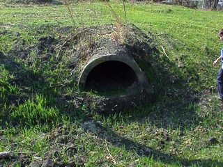
If the problem is generated as a result of construction activity by a private individual, the solution may be referred to the OWR's Permit Section for enforcement action. An OWR permit is required for work on Illinois streams if a mapped floodway exists at the project site or if the drainage area at the proposed work is greater than 1 sq. mi. in urban/urbanizing areas, or 10 sq. mi. in rural areas
When a request for assistance is received relative to a severe flood problem, it may be addressed through a study process which begins with an initial feasibility determination based on preliminary estimates of flood damages and potential solutions. This preliminary investigation may be in the form of a Reconnaissance Study in which pertinent, available flood data is collected through field activities including the operation of a modernized water resources data collection network and the acquisition of field survey data to determine whether a Strategic Planning Study is warranted. A Strategic Planning Study can take twelve months or longer to complete and provides an accurate prediction of flood damages and alternative solutions to the flood problem, including average annual benefits and costs associated with each alternative. OWR authority generally requires a favorable Benefit/Cost Ratio (B/C ratio equal or greater than 1.0) to proceed to a Project Planning Study and implementation as a total State project. Strategic Planning Studies are performed in-house, by consultants, or by cost sharing/coordination with other governmental agencies or entities.
Project Planning Studies are performed in the next phase of the study Danville - Vermilion Riverprocess. This phase is initiated if the local entity requesting assistance has agreed to be a local sponsor for a selected alternative. (see Criteria for State Participation below) Project Planning Studies are more detailed engineering design studies and are only performed for projects scheduled to be implemented as OWR projects. Environmental reviews and approvals as well as necessary permits are usually secured in this phase of the planning process.
Following the Project Planning Study phase, plans, specifications, permits and appropriation of funds, are the final steps required to bring projects to the implementation/construction phase.
OWR also participates in Federal programs within the legal authority of State Statutes. OWR is an active sponsor, along with other regional and local agencies, of floodwater management plans developed with NRCS, MWRD, and the U.S. Corps of Engineers assistance. Sponsor responsibilities include land acquisition needed for the structural measures and implementation of various non-structural programs and project operations and maintenance.
OWR involvement in a project may be dependent upon the circumstances surrounding the problem, but can generally be defined by the following criteria:
Flood damages exist which are related to overbank flooding. OWR tries to prioritize projects such that the most severely damaged areas receive priority consideration and assistance from State and Federal sources
Justification must be shown for State Water Resources funds used for a project. (Benefits greater than costs) State water resource projects are designed to maximize economic efficiency at minimal environmental impact and result in the maximum benefits for the least possible cost.
Each project must have a Local Sponsor(s) (generally a unit of local government). The local sponsor is responsible for the following:
a. Joining and remaining in good standing in the National Flood Insurance Program
b. Acquiring all necessary land rights for construction, operation, and maintenance of the project;
c. Any utility alterations required for the project
d. Payment of any construction costs above the amount of Water Resources participation;
e. Operation and maintenance of the project upon completion.
Project planning, environmental coordination, design, preparation of plans and specifications, and overseeing of construction can be done by either the local sponsor(s) or Water Resources if time and personnel are available. Water Resources pays contract bills as the work is completed. Reimbursement is not allowable.
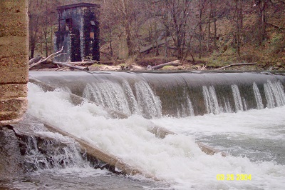
The Office of Water Resources/Division of Capital programs staff operates and maintains the Stratton Lock and Dam and Algonquin Dam on the Fox River and operates and maintains Sinnissippi Dam on the Rock River.
The Illinois Department of Natural Resources, Office of Water Resources is charged “to study and investigate ways and means by which various water uses may be coordinated to the end that the water resources of the State be put to their maximum beneficial use and, in connection therewith, to request any department or agency of the State to make surveys, studies, investigations, prepare plans, reports and furnish such data and information as may be necessary.
The Division of Capital Programs gathers water resource data prior, during and following a flood or other disaster. This data is assembled and disseminated to various state and local agencies. Representatives of the Division act as the Technical Liaison to the Illinois Emergency Management Agency (IEMA) and provide daily briefings on flood conditions of monitored streams throughout the state and its boundary waters. In cooperation with the United States Geological Survey (USGS), a summary sheet of river stage information is provided on their website. Personnel of the Division of Capital Programs also assists with the State Water Plan Task Force (SWPTF) which was created in 1980 to guide policy decisions regarding the adequacy of programs to deal with an increasing number of water issues and to prepare a State Water Plan for Illinois. The SWPTF is an interagency group composed of management-level representatives from state resource agencies, the University of Illinois, and the Governor’s Office. The SWPTF is chaired by the Director of the IDNR Office of Water Resources. 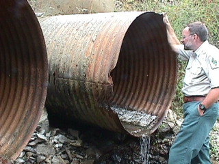
The Office of Water Resources is the State of Illinois’ representative on the board of the Upper Mississippi River Basin Association (UMRBA). UMRBA is a regional interstate organization formed by the Governors of Illinois, Iowa, Minnesota, Missouri, and Wisconsin to coordinate the states' river-related programs and policies and work with federal agencies that have river responsibilities. UMRBA is involved with programs related to commercial navigation, ecosystem restoration, water quality, aquatic nuisance species, hazardous spills, flood risk management, water supply, and other water resource issues.